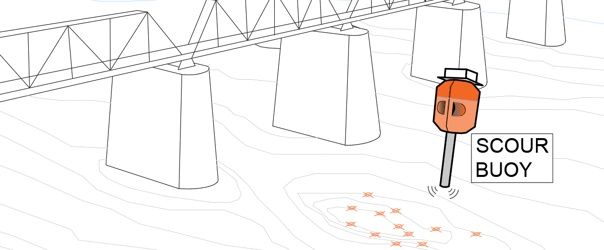
Bridge pier scour monitoring
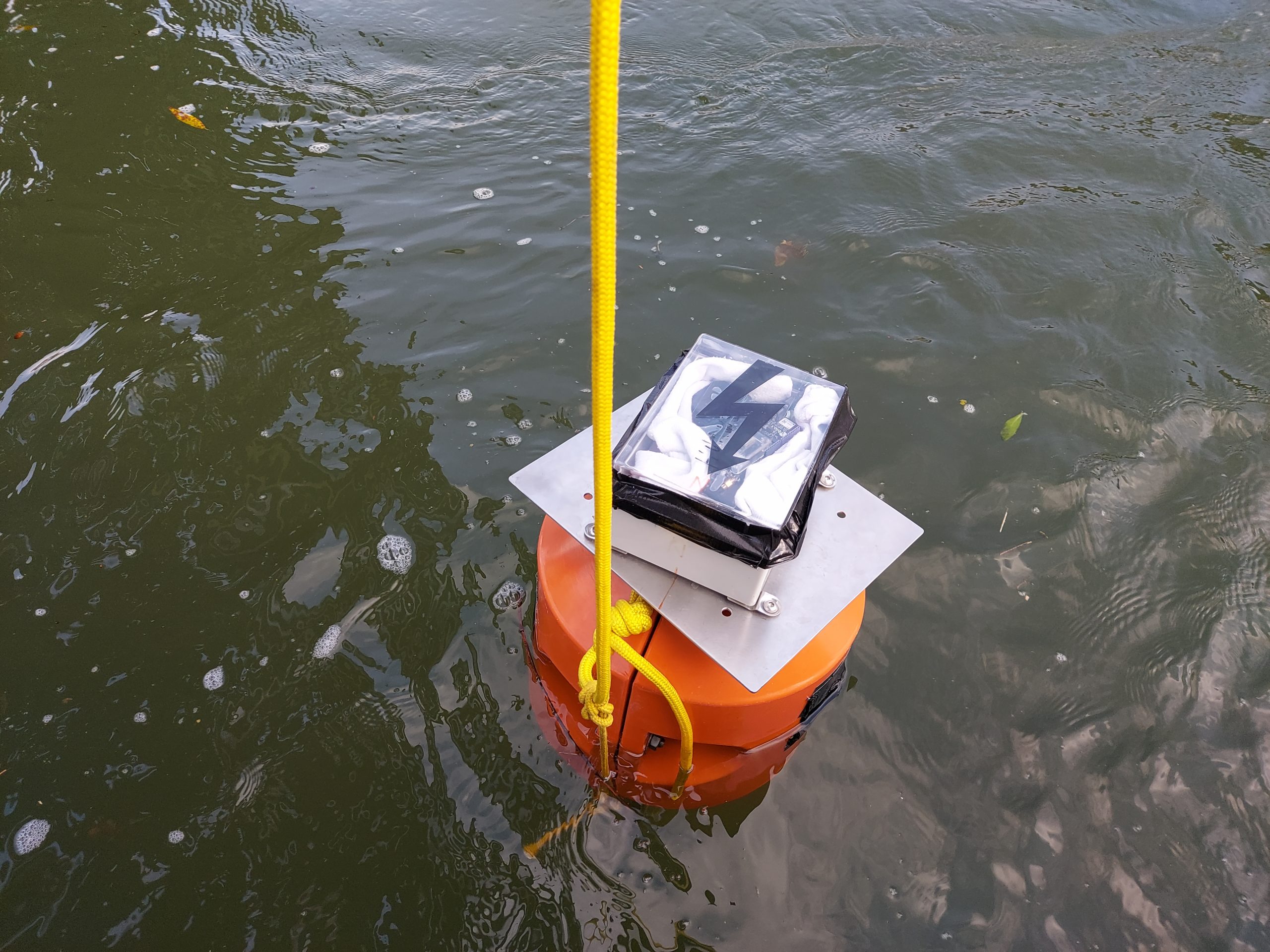
ScourBuoy prototype is assembled from commercial sensors capable of simultaneous measurement of:
• Flow depth
• GPS location
• Compass orientation and tilt
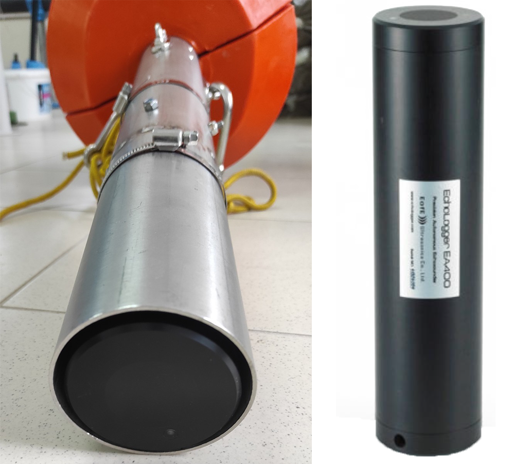
Type: The Echologger EA400
Autonomous Echosounder
Echosounder is an acoustic singlebeam depth sensor. It measures the travel time of a sonar pulse emitted from a transducer to the river bottom.
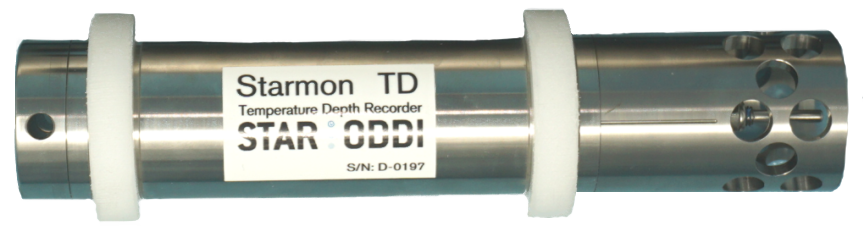
Type: Starmon tilt
Compass and Tilt data recorder
Device for tracking orientation in underwater conditions. It records acceleration, compass heading and tilt up to 100 Hz frequency.
Mobile device geolocation
Triangulation of the mobile signal from the ScourBuoy and adjacent fixed locations enables its accurate geoposition.
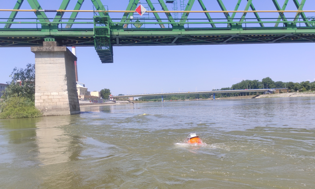
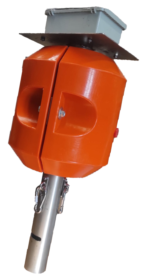
During survey ScourBuoy is anchored to the bridge. During the measurement buoy is constantly logging the data from the sensors. Flow deflects the buoy and data is measured over the wider spatial domain.
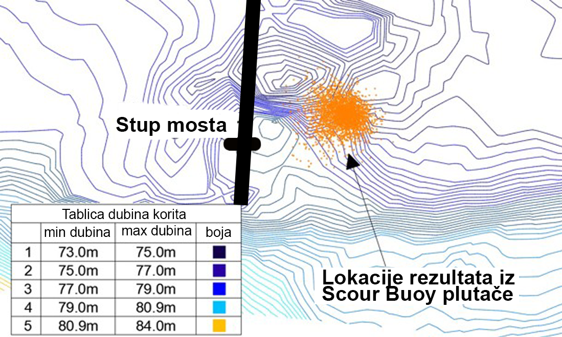
ScourBuoy data is post-processed into river bathymetry maps and scour hole depth and extent is extracted from the morphology..